A theme was starting to form on our trip — underestimating the roads in Kyrgyzstan during the planning process was proving problematic. Maps were/are wrong, and the rough roads were causing significant delays.
Knowing we had a seven-hour journey ahead, we woke up very early to hit the road to Tash Rabat. We wanted to drive the Pamir Highway, and decided we would do this from Bishkek to Osh, Kyrgyzstan via Tajikistan. This isn’t a problem in the summer, but in all of my research, I didn’t realize this route would be inaccessible in March.
We were going to cross in Sary-Tash, and take the opportunity to visit the 15th-century caravensari, Tash Rabat. Tash Rabat is in a secluded area within the mountains (honestly, this describes a lot of Central Asia, but this area was actually very secluded). When I was initially looking at where to stay, I found a yurt camp nearby, and decided to reach out to them. Unfortunately, they do not operate in the winter, so we decided to stay in Naryn instead.
The drive from Karakol was scheduled to take 7 hours so we planned a brief stop to see a boulder of Yuri Gagarin on the way.
Finding Yuri Gagarin on the Road to Tash Rabat
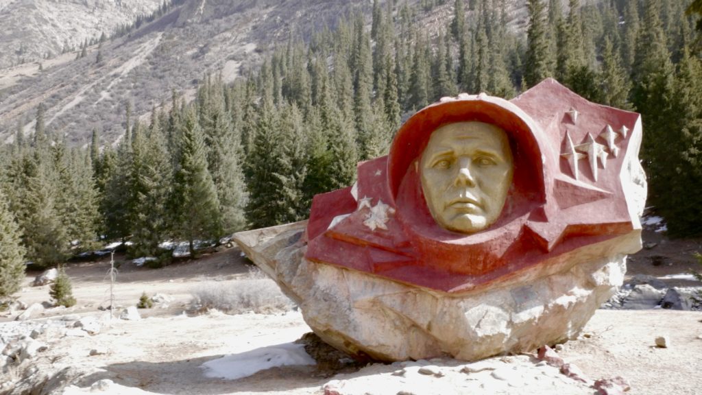
There are a lot of interesting historic monuments in former soviet countries. This boulder with Yuri Gagarin’s face in it was located south of Lake Issyk-kul, down a dirt mountain road. As you turn down the road it had a sign warning drivers of avalanches and mudslides. I ignored these.
The boulder itself was situated in a stunning mountain landscape, in front of a flowing stream.
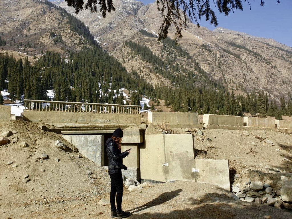
After visiting Yuri, we plugged Tash Rabat into Maps.me. The route it told me to take was different than the original one I found on Google Maps. I went to try, and find the alternate route, but I did not have cell service. This meant I had to turn around, and take a longer route to Naryn.
Driving the Road to Tash Rabat
Google Maps and Maps.me did not account for the road conditions or roadblocks. This meant that during the planning process, what seemed achievable often was not.
These apps did not consider the ever changing landscape, degrading roads from the melting snow, having to constantly swerve around potholes and livestock. This caused significant delays.
By the time we finally made it to Naryn it was 5 PM and the sun was starting to set behind the mountains. We started to drive down the road from Naryn to Tash Rabat, but realized we should turn around. The drive was “2 hours and 15 minutes,” and we would have to drive a mountain road in the dark, with no street lights. As much as we wanted to see Tash Rabat, it was not worth the risk.
As we returned to the hotel, we asked for a dinner recommendation. We walked down a few alleys that were a mixture of wet and frozen mud to another hotel. We had another amazing meal including my favourite (roasting beef), and my friend’s favourite (shorpo soup). After dinner we headed back to the hotel as we had a long twelve hour drive scheduled for the next day.
Underestimating the Roads in Kyrgyzstan – Trying to Make It to Sary-Tash in March
The next day, I woke up thinking we were going to make it to Sary-Tash. Basically everything went wrong this day. Another day of underestimating the roads in Kyrgyzstan 😢.
Honestly, I’m writing this part 6 years later, and I still can’t believe this day.
The first part was, this was supposed to be a 10 hr driving day, by Google Maps estimates. Which really meant we probably never would have made it to Sary-Tash in one day from Naryn anyways.
Anyways, so we drive through this gorgeous mountain pass (I forget what it was called), but since it was March, the snow was melting, and freezing again.
I was really impressed with myself in driving through the winding, dirt roads. Honking my horn often, just in case another car was speeding around the corner.
Ignoring My Better Judgement – Mistakes Were Made
Eventually we made it to a nice bit of paved road, but maps told us to deviate and go up this smaller, (unpaved) mountainous road. We figured, what do we know about this part of the world, maps must be right (ignoring all of our earlier lessons), and turned on to the mud mountain from hell. Another classic example of underestimating the roads in Kyrgyzstan.
Like I mentioned before, in mid-March the snow on the mountains was melting on to the dirt roads, and forming nice mud puddles and grooves. We had to get a bit of a running start to just get over the initial puddle, and up the first hill. This was roughly a little larger than the width of the car. This should have been the first sign that I should have just kept driving down the paved portion, but no.
Eventually we ended up in a really bad bit of the mountain, the mud grooves were controlling which direction the car was moving, and I was in 4WD. I was unable to steer. There was no way we would be able to turn around so we kept going.
We were stuck for probably 10 minutes. Locals obviously know not to drive through this pass this time of year.
During my time of rocking back and forth, a boy on a horse galloped up beside us. We rolled down our window, and he told us to keep going straight, and we would make it back to the paved road. There was no way I could turn around. The road was basically the width of the car, so I just kept switching between drive, and reverse until we got the car free.
Relief Followed by Sadness
We followed maps on to the paved road (thankfully)-the road we were supposed to be on the whole time.
Maps then decided to tell us to turn left down the only road that could take us to Sary-Tash (which was of course covered in 4 feet of snow for as far as the eye could see). I thought there must be another route (there was not-there are only so many routes through mountains, especially in March).
After asking two separate groups of locals, we were told the road was closed until June, and the only road to Tajikistan is back through Bishkek (which we left three days before) and on to Osh (supposedly a 14 hr drive from where we were in the mountains).
I felt so defeated, and frankly kind of stupid for thinking Maps would operate the same way as they did at home in Canada. The man we rented the rental car through asked me if I wanted to run our route by him before we left, but I felt I knew better (this was so ignorant) because I did so much research before we left.
It was getting late in the day, and the sun would set soon, so we ended driving to Kazarman to stay for the night.
Arriving in Kazarman
I was so numb. Getting stuck in the mountain, and not knowing if we would get out (or if I would end up driving off the side of the mountain), frankly traumatized me. We ended up at a homestay, with a really nice family.
The daughter of the owner took us to a phone shop in the village where we could get service to call our rental car company. I didn’t know what to do. Adding three days to our itinerary would mess everything up. My whole planned route was messed up at this point, but I remembered that the rental car company told us if we needed help at anytime to call them. They would even send a driver.
We arranged for a driver to take us, and our vehicle back the 14 hrs to Bishkek. It took me three days to get us this far, there was no way I could make it back to Bishkek with my cautious driving. The driver was the right call.
They weren’t arriving until the morning, so we went for dinner. I could not tell you where we went to eat, but it was recommended to us from our homestay. In normal circumstances, I probably would not have ate there, but I was so dissociated, that I couldn’t be bothered to be uncomfortable about the interior. It’s not like we had a lot of options.
I remember sitting at the table, and a cockroach crawling on the wall beside me, and I didn’t care at all. I’m actually kind of myself for realizing this wasn’t something to be bothered by, and this was a really authentic experience that I will never forget.
Back to Bishkek
We made it back to Bishkek in one day. I am so thankful for the driver. It gave me the much needed day to reflect, and recover from the mental anguish, and to adjust the rest of our trip.
The drive was beautiful, and it was nice being a passenger for a day.
Even though things didn’t go to plan, I learned so many valuable life lessons from underestimating the roads in Kyrgyzstan. I grew as a traveller, and this will stay with me when planning for future trips, and to share these lessons with people like you. I do wish I could have driven the Pamir Highway though. Guess this will have to be saved for another trip.